
Mars Global Surveyor Magnetic Field Experiment
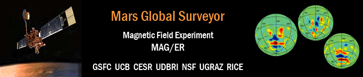
Mars Crustal Magnetization Data
(Quicklook Version 0.1/02/00 - WEB distribution 02/18/00)
The magnetic field data, (b_r, b_theta, b_phi) are given in a traditional spherical polar coordinate system defined at the spacecraft location with b_r defined positive outward, b_theta positive southward and b_phi positive eastward.
The magnetic field spatial variability over the scale covered by each 3-dimensional bin is significant in regions of high crustal magnetization. Hence the standard deviation associated with each bin average where 3 or more measurements are included is provided for information. If less than 3 data points are used in the average, the standard deviation is assumed to be zero. The number of points in a given bin is also dependent on the spacecraft telemetry rate. At high data rates several points may be collected along the same orbital trajectory within a given bin.
The data are presented as a 10 column table defined as follows:
1          2        3            4          5            6
------------------------------------------------------------------

longitude  latitude altitude     b_r        b_theta      b_phi
(deg)      (deg)    (km)         (nT)       (nT)         (nT)
------------------------------------------------------------------


7            8          9            10
-----------------------------------------------

number of    sigma_r    sigma_theta  sigma_phi
data points  (nT)       (nT)         (nT)
-----------------------------------------------
The data format is standard ASCII text which has been compressed (ZIP) for ease of distribution.
For information or assistance with the preliminary Mars Magnetization Quicklook Dataset (MMQD) please contact Dr. Mario H. Acuña at Mario.H.Acuna.1@gsfc.nasa.gov. Comments about the format, utility and use of this data set are most welcome.
18 February 2000
NASA/ Goddard Space Flight Center, Code 695
Laboratory for Extraterrestrial Physics
Greenbelt, MD 20771
USA
- NASA Official: Ron Oliversen
- Email: Ronald.J.Oliversen@nasa.gov
- Curator: Patricia Lawton, ADNET Systems, Inc.
- Email: Patricia.J.Lawton@nasa.gov
- Last Modified: 18 January 2017